Cities change in bursts, and neighbourhoods are out of sync
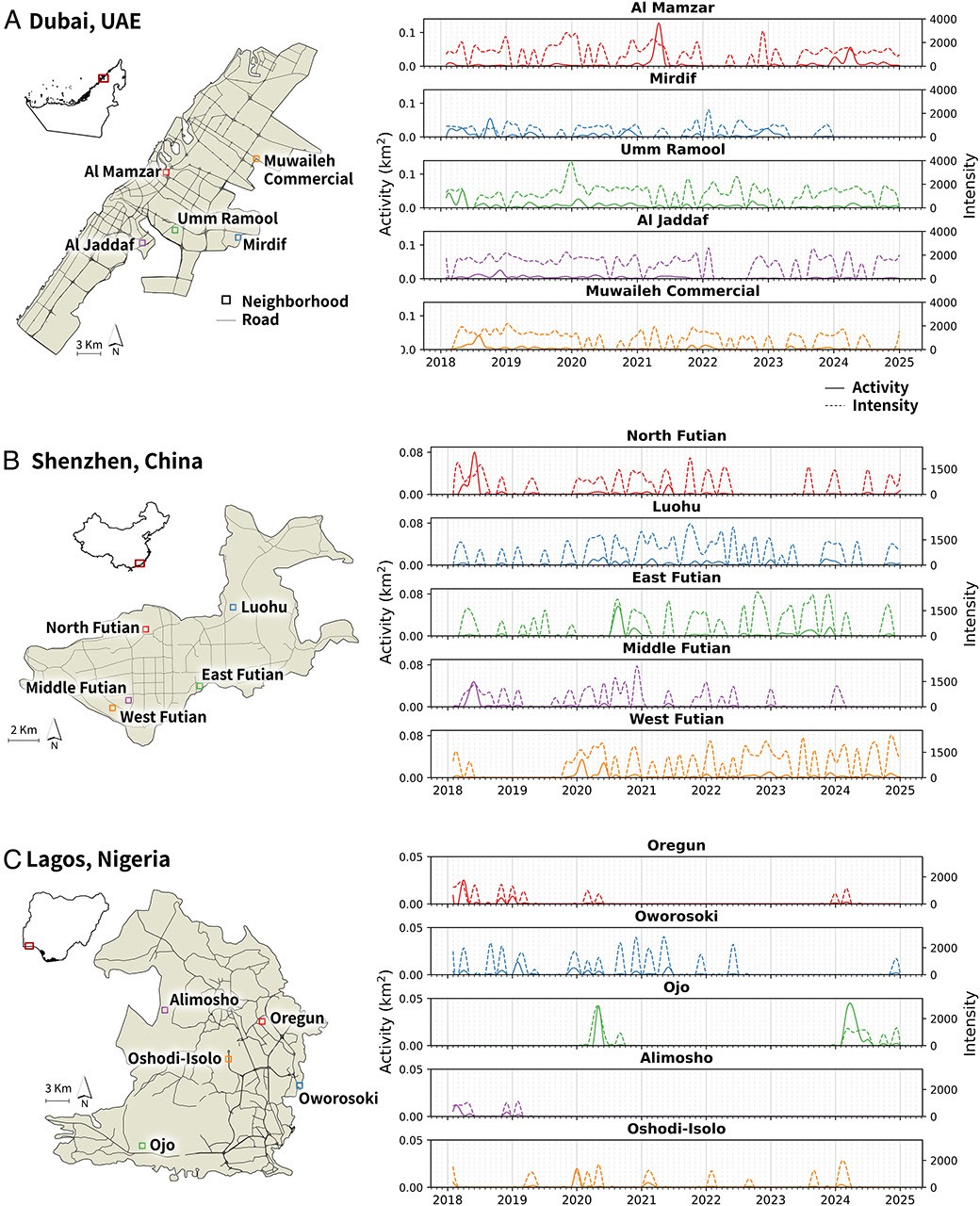
Researchers combined Harmonized Landsat and Sentinel-2 imagery, providing a new observation about every two to three days, with deep learning and time-series analysis. The CAPES method first identifies potentially changing areas and then excludes stable pixels. Across Dubai, Lagos, Mexico City, Mumbai, Seattle and Shenzhen, the team derived two measures: activity, the area undergoing change, and intensity, the magnitude of that change. The same pattern appeared across all six cities: construction and demolition occurred in cycles and spikes rather than as a smooth trend, while nearby neighbourhoods often peaked at different times.
A radar for investigation, not an automatic decision
For a city team, the series could reveal earlier than a citywide average where rapid growth is pressuring roads, water, schools or emergency services, and where activity is stalling. But a satellite signal does not explain cause on its own: repair, new construction and demolition may look similar, while clouds and surface conditions affect observations. Urban Pulse is therefore best used as a queue of hypotheses: detect an unusual spike, compare it with permits, mobility and infrastructure data, and then investigate on the ground. Frequent observation becomes a planning tool only when it is paired with local verification.
Sources
- NASA Science — A City Doesn't Grow at One Speed · 30 October 2026
- PNAS — The Urban Pulse · 8 June 2026